
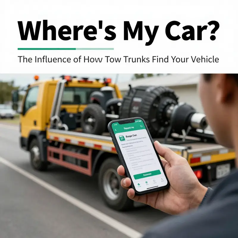
When you’re stranded due to a breakdown or accident, one of your top concerns is how to get your car to safety. Tow trucks rely heavily on accurate information to locate your vehicle. Did you know that communication plays a pivotal role in this process? This article delves into the mechanics of how tow trucks determine where your car is, covering the impact of GPS technology, the role of roadside assistance services, and advanced vehicle technology. Understanding each element will empower you, as a local driver or property manager, to ensure swift and efficient towing service when necessary.
Where Help Finds You: The GPS, Telematics, and Real-Time Communication That Guide Tow Trucks to Your Stranded Vehicle

When a car breaks down or is involved in a fender-bender, the instinct is to call for help. But the core question that follows is practical and almost logistical: how do tow trucks actually locate your car in the moment you need them most? The short answer is that they rely on a coordinated blend of location data, communication networks, and fleet-management software. There is no single magic trick that lets a tow operator “know” where you are without you or your vehicle providing some precise information. Instead, responders use a chain of data points that converge to deliver you, quickly and efficiently, to the right road, at the right lane, with the right equipment. The result is not just a guess but a calibrated estimate built from GPS coordinates, phone-based positioning, and the vehicle’s own onboard systems. It is a modern choreography of signals that turns a potentially isolated moment into a managed response.
The process typically starts the moment you reach out for assistance. When you call a roadside service, a dispatcher becomes the hub of a complex information ecosystem. The first data point is the location details you share: a street address, an intersection, a landmark, or a highway mile marker. However, in many cases you can also authorize the service to access your location data automatically through a connected-car app or a mobile device. If you’re using a roadside assistance program with a companion app, the app can transmit live GPS data from your phone, sometimes with your explicit consent, directly to the dispatch system. If you rely solely on a phone call, the dispatcher will guide you through describing exact coordinates or familiar references and may request additional information like nearby exits, signage, or notable surroundings. Either way, the starting point is your precise location, but the speed and accuracy of the response improve when the data can be verified, augmented, and constantly updated.
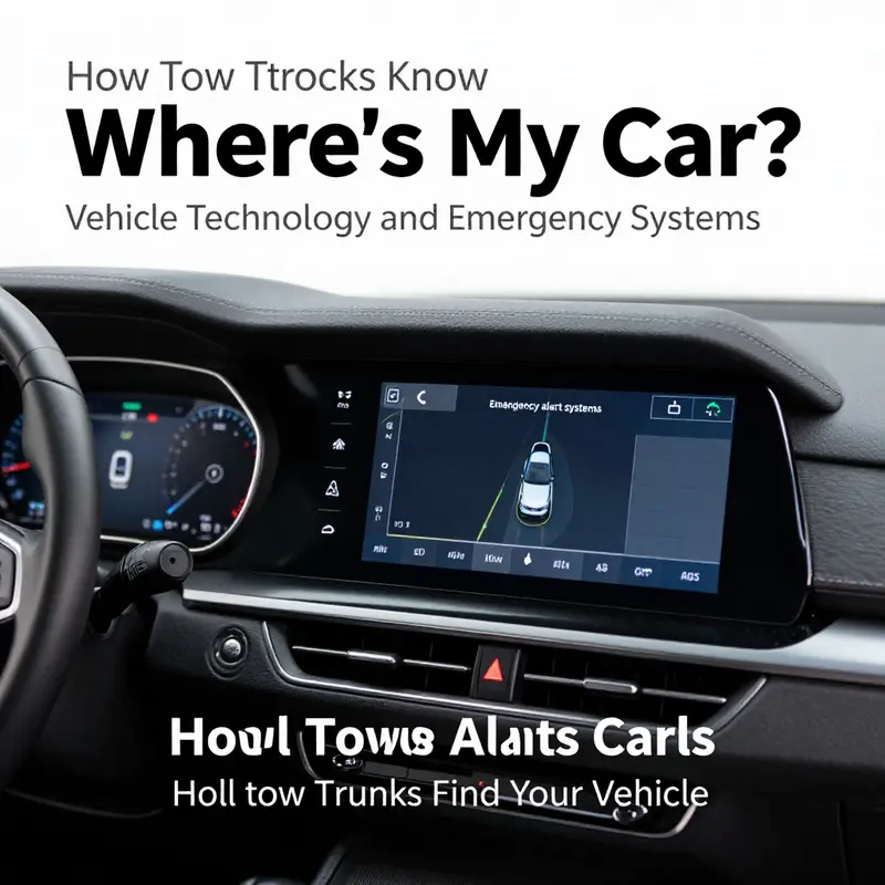
From there, a quiet but powerful layer emerges: the vehicle’s own telematics and the broader connected-device ecosystem. Modern cars—especially newer models—embed telematics modules that constantly monitor position via GPS, speed, and direction. These data streams can be shared with authorized service providers through built-in networks or third-party apps. If you have activated a connected-car service, your vehicle can relay its exact coordinates to the dispatcher in real time, even before you describe your whereabouts or step outside the car to give directions. The effectiveness of this system hinges on two things: the car’s connection to a cellular network or satellite pathway, and the authorization to share data with your chosen service provider. When those conditions are met, the operator sees a live feed of your vehicle’s coordinates, updating every few seconds as you move or as the tow truck closes in.
Mobile devices play an equally pivotal role. A significant share of location data comes from your smartphone, which continuously uses GPS, cellular, and sometimes Wi-Fi signals to determine your position. Even when you’re inside a stalled vehicle, the phone can maintain a rough fix on location. Dispatch software can fuse this with vehicle data to generate a marked location on a map that drives the first wave of dispatch decisions. This data fusion is not merely about accuracy but about speed. The closer a dispatcher can locate the vehicle, the shorter the first leg of the journey and the smaller the margin for misinterpretation as the tow truck navigates complex routes through urban cores, construction zones, or crowded highway shoulders.
The dispatch system itself is a quiet engine of optimization. It uses real-time vehicle tracking to determine the nearest available tow truck that can handle your needs—whether your situation requires a standard tow, a flatbed, or more specialized assistance. Proximity is a major factor, but so are the service constraints: the truck’s current load, the size and type of the vehicle to be towed, and the driver’s working hours or the operator’s internal guidelines for safety. The result is a dynamic decision model that prioritizes quick arrival while preserving safety and cost efficiency. The system then reflects this choice back to the selected tow truck, sharing the location data, your vehicle details, and the estimated time of arrival. In this sense, the tow truck is not wandering toward a vague target; it is guided by live coordinates that continuously recalibrate as conditions change, from traffic congestion to a sudden detour or a change in your own location as you move toward a safer roadside spot.
Onboard equipment in the tow trucks themselves further enhances the precision and speed of response. Modern fleets often deploy devices that integrate GPS, cellular connectivity, and sometimes satellite communication into a single, robust system. This onboard stack enables two-way communication between the driver and the central dispatch, so the operator can relay turn-by-turn directions, receive updates on road conditions, and confirm the arrival exactness as the vehicle approaches the scene. The end-to-end flow looks like this: the tow truck transmits its own GPS-equipped location to the dispatch center, the center cross-references it with the customer’s location data, and a live route is computed that accounts for real-time traffic, road closures, and any necessary safety zones for staging an approach. In the field, this translates to a driver who can focus on safety—maneuvering into a defensible position, securing the vehicle, and coordinating with any bystanders or law enforcement—while the digital system ensures the vehicle is directed to the precise point where ask meets answer.
The role of built-in vehicle telematics cannot be overstated. In today’s era, many vehicles have integrated systems that can automatically alert a response network in case of a crash or mechanical failure. When such a system detects an incident, it can initiate a call for help or transmit location coordinates to the service provider even before the occupant can push the button or provide details. This capability reduces the time between the event and the arrival of assistance, which is critical for safety and for preserving the condition of the vehicle. It is not unusual for these systems to volley location data through multiple channels: directly from the vehicle’s telematics to the dispatcher, from the phone’s location service to the app, and from the app to the central operations center. The redundancy built into this network is a feature as much as a contingency, ensuring that if one link fails, another can still carry the data forward.
But accuracy is not guaranteed by technology alone. The world presents quirks that can test any locate-and-arrive system. Satellite and GPS signals are highly accurate outdoors but can degrade in cities with tall buildings, under dense tree canopies, or inside tunnels and deep parking structures. In such moments, the system leans more heavily on the mobile network and on nearby devices that can triangulate a position based on multiple observed signals. The result is a progressively refined fix: starting with a broad map pin, then tightening to a more precise cross-street, and finally narrowing to a spot on the shoulder or a designated turnout. When you’re asked to provide a landmark or the closest mile maker, you’re not simply repeating information—you’re helping calibrate the data that the dispatcher has already begun to assemble. It is a collaborative act that turns the plan into a precise, executable route.
The potential for future improvements is real and exciting, and it lies in the broader ecosystem around vehicles, roadways, and networks. Vehicle-to-everything, or V2X, technology promises to extend the dialogue beyond a single vehicle and its driver to include traffic signals, road sensors, and nearby vehicles. In a connected urban environment, a tow truck could be guided not only by its own path but by real-time cues from the infrastructure around it. A traffic signal about to change, a construction zone opening, or a stalled vehicle further down the road could all feed into the dispatch system to adjust routing on the fly. In practice, this would reduce the time spent in uncertain zones and improve safety by coordinating movements with other road users. While the current landscape already relies on a layered approach to data—GPS coordinates, cellular data, and telematics—the next generation of emergency response could see these layers merge more tightly, powered by secure, standardized data exchanges across fleets, manufacturers, and municipal networks.
The practical takeaway for drivers and operators alike is simple in principle but multifaceted in execution. To maximize the speed and accuracy of locating your vehicle, you should share your location data where possible and be explicit about your surroundings when you call. If you’re able to use a roadside assistance app, enabling location sharing can significantly shorten the first mile of the journey because the dispatcher can drop a pin on a near-perfect map of your car’s position. If you rely on a manual description, use nearby landmarks, street names, and mile markers, and confirm the directions with the dispatcher as you proceed. For vehicle owners driving in unfamiliar areas or in dense urban centers, understanding that the data you provide works in concert with the car’s built-in systems, the tow truck’s onboard technology, and the dispatch center’s routing algorithms can also help you become a more effective partner in the rescue operation. The aim is to minimize ambiguity, maximize data fidelity, and translate every signal into a precise action that reduces wait times and accelerates safe recovery from the roadside.
This integrated model of locating a vehicle also reflects an organizational discipline that many towing fleets carry into daily practice. Fleet-management professionals design and monitor the flow of information to ensure that proximity, availability, and the correct service type align with each call. The software that orchestrates this process is built to track the real-time location of all trucks in the network, so the closest appropriate unit is assigned and then guided toward you with continuous updates. The result is a tightly choreographed response where the driver’s job is to execute the plan with professional safety and care, while the system’s job is to ensure the plan remains optimal as new data comes in. The strengths of this approach lie not only in the sophistication of the technology, but in the discipline of the people who operate it—the dispatchers who interpret data streams, the drivers who translate digital directions into real-world action, and the management teams who continually refine the algorithms that determine the next best move.
As you consider this network of GPS, telematics, and human oversight, you may notice how closely it mirrors the broader evolution of emergency response in transportation. The same logic that improves response times for a tow truck also underpins services that coordinate ambulances, fire units, and incident response teams. The difference in each case is the object being located and the constraints on access to data, but the core principle remains: accurate location data, delivered quickly, improves outcomes. The idea is to minimize the gap between a call for help and the arrival of assistance by ensuring that the data streams guiding the response are precise, secure, and continuously updated. In practice, this means the customer, the vehicle, and the fleet are all participants in a shared system designed to move information with a minimum of friction and a maximum of reliability. As fleets continue to standardize procedures, invest in telematics capabilities, and explore the potential of advanced networks, the ability of tow trucks to locate a vehicle will keep pace with the expectations of drivers and the demands of modern roadways.
This ongoing integration of technologies and processes does not diminish the human element. It multiplies it, enabling a more predictable and safer rescue. The driver can focus on handling the physical tasks involved in securing the vehicle and navigating a potentially hazardous roadside environment. The dispatcher can coordinate multiple calls, prioritize safety, and ensure that every mile of the journey is optimized. And the vehicle’s own systems can provide an extra layer of assurance, signaling when the data being shared is accurate and when it needs recalibration due to signal loss or changing conditions. The overall effect is a more resilient system in which the location of a vehicle is not a mystery but a well-managed datum that travels across networks, devices, and people in a tightly choreographed sequence.
For readers who want to explore the technical and standards-based foundations of these capabilities, the evolution is documented in professional resources that discuss how GPS, wireless communications, and fleet-management protocols come together in emergency contexts. The focus is not on any single device or service, but on interoperable architectures that allow different fleets, software platforms, and vehicle makers to participate in a common workflow. This interoperability ensures that, regardless of who provides the roadside service, the data flows remain consistent, traceable, and actionable. In practice, this translates to faster arrivals, more accurate positioning, and safer work environments for tow operators who are navigating the hazards of traffic and weather while performing a rescue.
As a closing reflection on the current state and the near-term outlook, consider how an ordinary call for help becomes a carefully managed data event. A few clicks, or even a few words, can cascade into a live map with a moving target, a driver who receives precise instructions, and a customer who experiences a shorter wait time and a safer roadside recovery. This is not about a single technology; it is about a system of signals, protocols, and human decisions that, when aligned, turns chaos into order. It is the quiet efficiency behind the scenes that makes the familiar sight of a tow truck arriving at the exact location you described—or, better yet, the exact location determined by converging GPS, connected-car data, and real-time dispatch—a testament to how far the industry has come and how much further it can go with ongoing innovation. For those who want to dive deeper into the standards and technical underpinnings of these capabilities, a reliable overview is available from trusted standards organizations and technical authorities.
External resources for further exploration include general standards and technical documentation that help explain how emergency and roadside-response systems operate in modern transportation networks. For a standards-based, technical overview, see https://www.nist.gov/.
Pinpoint at the Point of Need: How Roadside Aid Finds Your Car Without a Crystal Ball
When a vehicle fails on a busy road or rolls to a stop in a quiet cul-de-sac, the driver’s first instinct is often to broadcast a simple, practical request for help: where exactly is my car? The answer, in practice, becomes a careful fusion of human communication and technology that no tow truck can operate without. The process starts the moment you pick up the phone, tap a button, or press an SOS, and it unfolds as a choreography of data, signals, and dispatch decisions that must move with speed and accuracy. Tow operators do not float over the landscape with some built‑in magical sense of location. They rely on precise information that you provide or that emerges from the car and its connected ecosystem. Location, in this context, is both a physical coordinate and a mapped sequence of real-world identifiers—the street, the nearest cross, the mile marker on a highway, a parking lot corner, or a landmark that a responder can recognize at a glance. The reliability of that location determines not only how fast a tow arrives but how safely the vehicle is recovered and secured. In this sense, the location data is the first critical step in a chain that links the stranded motorist to help, the dispatcher to a signed‑on driver, and the tow truck to the exact scene where the incident occurred.
The moment you reach out for help, the system begins to hum with two parallel streams: the human stream and the machine stream. On the human side, the caller provides the basic facts—the service type, a rough directional cue, and any obvious hazards. The human agent, whether responding through a roadside assistance program, an insurance provider, or a vehicle manufacturer’s emergency protocol, then asks targeted questions to triangulate the location. Is the car on a particular street? At what cross streets does it sit? Is it near a mile marker, an exit, or a distinctive building? The objective is to convert a soft description into a hard coordinate that can be fed into a dispatch map and conveyed to a driver who is en route. On the machine side, the vehicle itself, if equipped with telematics, can begin to share a precise coordinate almost as soon as an emergency or SOS is triggered. The car’s built‑in systems, when activated by a crash sensor or a manual distress signal, can automatically broadcast its location through cellular networks and satellite positioning. This automatic sharing accelerates the process and can reduce the time between call and pickup, especially when the driver cannot clearly describe their surroundings due to injury, stress, or language barriers. The two streams—human communication and device data—converge in the dispatch center, where software tools translate raw coordinates into a working order: a route to the vehicle, the type of equipment needed, and an estimated time of arrival.
The practical reality is that not every car has a built‑in locator that can beam its location to a dispatcher. Even when a vehicle has telematics, there are variables that can delay or distort the data. Cellular coverage can falter in rural pockets or underground garages, turning a smooth transmission into a sporadic trickle of updates. GPS signals can be obstructed by tall buildings, dense trees, or weather conditions that dampen satellite visibility. In such cases, the human agent must step in with manual verification—consulting the caller for the most accurate description, cross‑checking the nearest landmarks, and, when possible, guiding the driver to move the vehicle to a safer location where it is easier to access. This is why the initial contact remains such a critical phase; it is not merely a matter of pressing a button and waiting. It is a dynamic conversation that merges the car’s digital footprints with real‑world cues that a human can interpret, especially in complex environments like multi‑lane highways, busy city streets, or unfamiliar neighborhoods.
In the modern ecosystem of roadside assistance, the option to share real‑time location has become a standard feature rather than a luxury. Mobile apps linked to a service plan or a vehicle’s connected services can pull a precise point from the phone’s GPS or from the vehicle’s own sensors, then relay that point to the dispatcher. When the driver enables location sharing, the system can transmit a live breadcrumb of where the car is currently, where it has been, and how fast it is moving. This real‑time capability makes a tangible difference in the speed and efficiency of a tow. It allows the operator to pre‑stage the response, assign the closest available tow truck, and even preemptively print a route that avoids known delays. For the driver, it reduces the cognitive load at a moment of stress. Instead of giving directions while trying to stay safe and warm or dry, the driver simply confirms a few details and lets the technology do the heavy lifting. The net effect is a smoother experience for the stranded motorist and a faster, more precise arrival for the tow truck.
But the reach of location data goes beyond the immediate rescue. When a vehicle is involved in a crash and triggers an emergency system, the telematics network can automatically broadcast the car’s exact position to the appropriate responders. In such cases, every second can matter, and the data becomes a lifeline that guides emergency services to the scene without delay. The same telematics framework can also improve incident documentation for the towing operator and the responder teams, providing a shared, timestamped record of where the car was at the time of distress and how the location evolved as rescue operations progressed. This shared frame of reference is invaluable for coordinating hazardous scenes, arranging safe extraction routes, and ensuring that the vehicle is moved according to safety regulations and local laws.
At the same time, there are practical contingencies when telematics cannot help. For vehicles without built‑in systems, roadside providers offer alternatives that maintain a high standard of accuracy. A service app can rely on the phone’s GPS data or the user’s input to generate a precise pin on a map. In some cases, portable GPS trackers may be placed in the vehicle, owned by the service provider rather than the driver, which then transmits location data via a linked app or web portal. The goal across these options is the same: to provide a robust signal that the dispatcher can trust enough to guide a tow truck to the exact spot with minimal back‑and‑forth. In practice, a dispatcher may cross‑check the user’s pin with nearby landmarks, street names, or cross streets to ensure redundancy. This redundancy is essential because even a small error in location data can lead a driver to circle a block or pass a vehicle’s true location in tense moments. The layered approach—driver input, mobile location sharing, and optional tracker data—acts as a safety net that increases the likelihood of a correct drop‑pin and a rapid response.
Beyond the moment of dispatch, the chain of accuracy continues as the tow operator approaches the scene. The driver’s equipment and organizational practices shape how the location information gets translated into action. A well‑organized fleet will have standardized communication protocols, a clear set of questions for the caller, and a robust dispatch interface that shows live vehicle locations on a map. The operator can monitor traffic conditions, road closures, and weather patterns along the route, adjusting the ETA and routing as needed. This situational awareness is not merely a convenience; it is a safety feature that keeps the responder and the stranded motorist out of further risk. In many operations, this is where the concept of emergency readiness and standardization begins to intersect with real‑world performance. The systems that guide a tow truck from door to door are not static; they are updated through practice, feedback, and the evolving technology that supports mobile connectivity and cloud‑based dispatching. When a question arises about why a tow might take longer than expected, the answer often lies in the quality of the location data and the surrounding traffic realities rather than in the willingness of the driver to work quickly.
The complexity increases when a vehicle is towed without the owner’s knowledge or consent, such as in cases of illegal parking or impound. Law enforcement agencies and municipal towing operations may use GPS or other location tools to locate a vehicle if there is a legal justification or if the vehicle is part of a fleet that has tracking agreements. In these scenarios, the use of location data is tightly regulated to protect privacy and property rights. The key takeaway is that location data in these situations is not a magical compass that can reveal a car’s position everywhere at every moment. It is a carefully regulated signal, often limited to specific purposes, time windows, and custodians, governed by legal standards and privacy protections. This understanding helps reconcile the tension that some drivers feel around the visibility of their vehicle’s location with the practical needs of law enforcement, clearance of hazards, and efficient recovery operations.
In the ordinary, non‑emergency context, many drivers benefit from understanding the ecosystems that support location accuracy. If you are insured with a roadside assistance plan, you may have the option to share location automatically via your phone or the vehicle’s connected services. If your car lacks telematics, a simple, reliable approach is to keep a note of a nearby cross street, a nearby landmark, or even a photo of the scene to show the dispatcher. When you call, you can also describe your exact surroundings: the type of road, the number of lanes, whether you are on a shoulder, and if the vehicle is obstructing traffic or impairing visibility. These details may seem mundane, yet they anchor the dispatcher’s mental map and the driver’s approach to the scene. The ultimate effect is a faster, safer, and more predictable rescue operation, with fewer backtracks and less confusion about where the vehicle is, how to reach it, and when to expect help.
From a systems perspective, the interplay between driver input, telematics, and dispatch technology highlights a broader theme: the modern tow industry is as much a information enterprise as a manual service. It relies on accurate data capture, careful verification, and timely communication. The same principles that drive a successful rescue also guide the planning and execution of everyday operations. Fleet operators invest in training that emphasizes how to interpret ambiguous location cues and how to verify coordinates under pressure. They invest in processes that minimize the time needed to confirm the exact scene and to communicate the plan to the responder en route. And they invest in relationships with insurance providers, roadside assistance programs, and vehicle manufacturers to ensure compatibility and reliability across systems. The result is a smoother experience for the consumer and a more resilient service network that can adapt as technology evolves.
In keeping with this evolving landscape, it is worth acknowledging that not all roadside experiences are identical. The environment plays a large role in shaping how location data is captured and used. On a quiet residential street, a caller might provide a precise address and cross street with little ambiguity. On a sprawling highway, with cars streaming by at high speed, the dispatcher may lean more heavily on telematics and standardized waypoint data to ensure accuracy. In urban centers where GPS signals can be temporarily diverted by tall buildings or where network congestion can hamper data transmission, the human operator may rely more on synchronized ground details, such as the nearest exit, known landmarks, or a pre‑registered geofence for the service area. In all cases, the guiding principle remains consistent: the quicker and more reliable the location information, the faster the tow truck can begin its journey and the safer the operation will be for everyone involved.
The chapter you have read so far outlines a practical truth that sits at the core of modern roadside assistance: tow trucks know where your car is not because they possess some intrinsic sixth sense but because a carefully engineered mix of direct communication, built‑in location technology, and professional protocols creates a precise, actionable signal. The exact mix varies by car, by service plan, and by the geographic context, but the underlying logic endures. If a vehicle has telematics, it can speak up on its own terms. If not, the driver’s input, augmented by mobile location sharing or licensed tracking tools, becomes the indispensable anchor. The system’s success hinges on the willingness of drivers to engage with these tools in a straightforward way—sharing location accurately, staying reachable, and keeping the scene safe until the tow arrives. In return, the dispatcher and the operator can deliver a faster, more confident service that gets you back on the road with minimal delay and with fewer complications on the way to recovery.
As the road ahead continues to evolve, the relationship between technology, policy, and practice will only deepen. Telematics, mobile apps, and cloud‑driven dispatch platforms will become more integrated with vehicle design, roadside services, and even the legal framework that governs when and how location data can be used. The chapter that began with a simple question—where is my car?—ends with a broader understanding of how society marshals information to solve real, urgent problems on the road. In this light, the mystery of locating a vehicle becomes less about magic and more about the deliberate alignment of human judgment, device accuracy, and robust procedures that keep people safe and help arrive on scene with confidence. For readers who want a deeper look at how fleets coordinate this kind of emergency readiness and response, a related resource explores the standards and practices that guide emergency operations across diverse scenarios. This linked perspective helps readers see that locating a car is not a single step but a whole architecture of data, trust, and collaboration that keeps the roads moving even when things go wrong.
Internal link reference: fleets emergency response data and practices provide a broader view of how organized response teams coordinate, verify, and deploy help in time sensitive situations. See the broader discussion of fleets emergency response to understand how these systems scale from individual incidents to citywide readiness. fleets-emergency-response
External resource: for an overview of roadside assistance data and location services, see the general information on telematics and emergency access at a national level. This external resource offers context about how location data is used by responders and the safeguards that protect privacy during emergencies. aaa.com
Pinpointing a Stranded Car: The Tech Web Behind How Tow Trucks Find You Fast
When a vehicle stops on the shoulder, a tow truck doesn’t suddenly appear with a preloaded map inset in its bumper. What actually happens is a coordinated relay of information that arrives from the driver, from the vehicle itself, and through the dispatch network. The tale of how tow trucks know where your car is begins with the moment you reach out for help. You might call a roadside-assistance number, hail a local towing company, or reach emergency services after a crash. In each case, success hinges on you providing the most accurate description you can give—street address, landmark, or the exact intersection. In practice, that information acts like the starting coordinates for a complex navigation that will guide the nearest available tow truck toward you. The dispatch center, whether it’s a roadside-assistance provider, a local responder hub, or an emergency-services liaison, is the hub that translates your words into a route, and increasingly, into a set of live location signals. The driver who shows up is not merely following a street name; they are following data. And that data comes from a layered ecosystem of human input, vehicle-based sensors, and mobile networks that keep the location story connected and current. In this sense, tow trucks are not mind readers. They are participants in a relay race where each leg depends on the precision and timeliness of the information handed off to them.
The most straightforward scenario is the one in which you can provide a precise point of reference. You give a street address or a clearly identifiable intersection, or you tell the dispatcher you are at mile marker 42 on a particular highway. A map is consulted, the dispatcher assigns a truck, and the path to your location is drawn with real-time navigation. In this traditional sequence, the tow operator arrives with a clear target, much like a taxi that knows the exact pickup point. But the modern roadside ecosystem adds more threads to the thread of location data. As vehicles become more connected, and as smartphones and car systems become more capable of sharing information, the chance of a quick, precise arrival increases dramatically. The same system that helps police and paramedics find a crash site now helps tow operators reach a stranded car with less guesswork. This is not a single technology at work. It is a mesh of GPS, cellular signals, and automatic alerts that weave together into one dependable thread: your car’s location, kept up to date as you move, or as the landscape around you changes.
The second major strand in this web comes from the vehicle itself. In newer cars, built-in telematics can detect certain events—airbag deployment, a sudden, severe deceleration, engine failure, or a loss of connectivity that indicates the car has come to a stop under unusual circumstances. These events trigger automatic messages to a central call center or to a roadside-service platform. The location data appended to that alert is typically derived from the vehicle’s own GPS receiver and its cellular connection, which report the car’s position with remarkable speed. In seconds, a call center can see where the car is, who is inside, and what kind of help is most appropriate. If the vehicle is equipped with subscription-based telematics, the system can automatically initiate a dispatch without the driver ever making a call. In simple terms, your car can call for help, and the dispatcher can see where the car is, readying a tow truck long before the scene is visible to the naked eye. This scenario dramatically shortens response times and can be crucial in emergencies where minutes matter. It is also a reminder that tow trucks do not operate in a vacuum; they ride inside a broader safety and support network that many vehicles already participate in.
Telematics platforms—those built into brands’ systems and those embedded in after-market solutions—are the anchors of this automatic location flow. They rely on GPS to establish a precise coordinate, then transmit that coordinate through the cellular network to a data center. The data center processes the alert, checks it against the service’s current requests, and then routes a tow truck to the right location. Some systems are designed to share not only a point in time but a history of where the vehicle has been in the minutes leading up to the incident. This corridor of information can help responders understand whether the car is moving, whether the occupants may have left the car, or whether the car is in a position that requires special equipment to reach. For the dispatcher, this means less time spent on questions and more time spent on action.
For many drivers, the most familiar channel remains the phone call or the app request. Modern roadside assistance apps push a request for help directly to a dispatch center and, crucially, share the device’s live location in permissioned form. A user’s phone can act as a beacon, transmitting the exact position to the service provider and to the operator who will drive to that point. This is where the human and machine elements converge beautifully. The driver describes the situation, the app or phone transmits precise coordinates, and the dispatcher translates that data into a route with real-time traffic awareness, construction zones, and the fastest possible path. It is a layered approach that reduces the risk of arriving at the wrong street, wrong side of the road, or a location that is too far away to be practical. As such, the precise location is not a hidden secret kept behind a closed system; it is a shared datum that travels from your pocket to the service center, and then into the hands of the nearest available tow truck.
Even as this high-tech web strengthens, not every vehicle participates in every data stream. Some drivers still depend entirely on the information they share verbally with the dispatcher. In this more traditional mode, the accuracy hinges on your ability to describe nearby landmarks, street names, and intersections. The dispatcher will then use a combination of maps, local knowledge, and back-end data feeds to place the closest truck on the fastest route to your exact spot. In urban canyons, where GPS signals can bounce between tall buildings, these human-guided corrections become especially important. The dispatcher may confirm the location by cross-checking your description with nearby street addresses, nearby businesses, or mile markers. In this sense, the dispatch center acts as a translator—converting imperfect or evolving ground truth into actionable navigation for the tow driver.
The third leg of the web is the smartphone and mobile ecosystem that empowers individuals to share location with far more precision and control. A growing number of people use emergency SOS features on their phones, which can automatically broadcast location data to responders when activated. These features are not just about signaling distress; they are about delivering a precise coordinate to the networks that handle emergency dispatching. In addition to built-in phone safety features, many roadside apps also enable live location sharing. A driver in distress can open a dedicated app, authorize location sharing, and be guided toward help with what feels like a cockpit-grade navigation experience. The result is a faster, safer, and often more efficient recovery or rescue operation, since the name of the street and the visible landmarks do not need to be perfectly recalled under stress.
From the perspective of the tow operator on the road, this layered system changes the nature of the job in subtle but meaningful ways. The driver does not always need to point the truck at a single street address and wait for the GPS to confirm. Instead, the operator receives a location feed that is updated as the vehicle’s position changes, along with context about the incident. If the vehicle needs to be moved, the system can adjust the route in real time, and the tow truck can be guided to the new coordinates without starting the process from scratch. This dynamic is especially important for scenes that unfold under heavy traffic, at night, or in poor weather conditions, where every second saved in navigation translates into reduced exposure for the driver and occupants and a faster return to safety. It is a practical demonstration of how a dispatch-centered workflow can leverage real-time data to improve outcomes on both sides of the emergency equation.
Yet, the practical reality remains that not every call benefits from automatic location sharing. Some situations involve a driver who is not in a vehicle with telematics enabled, or a passenger who cannot authorize data sharing. In those cases, the quality of the information depends entirely on what the driver can convey at the outset. The dispatcher may then rely on nearby cross streets, business names, weather conditions, and the car’s approximate position as described by the person in need of help. The presence of a mobile app or a telematics-enabled vehicle can turn a potentially ambiguous call into a precise dispatch, but the absence of these features does not render the process opaque. It simply raises the likelihood that your input will need to be more exact, and the tow operator will validate the location with the client or with nearby landmarks along the route. The key takeaway is that the system is flexible: it can perform with high automation where available, while still functioning with traditional, human-centered communication when technology coverage is limited.
As a reader of the broader landscape, you may wonder how these data flows intersect with privacy and consent. The location transmitted during a roadside emergency is not a random or indefinite stream; it is a bounded data exchange tied to a specific incident, often governed by the terms of service of the telematics provider and by the subscription status of the vehicle owner. In practice, most providers emphasize privacy by default: location data is shared with authorized responders, not broadcast openly, and is accessible only for the duration necessary to manage the incident. When you sign up for roadside assistance or vehicle telematics, you consent to the transmission of location data during emergencies or when you actively request service. This is a trade-off that many drivers accept for the benefit of faster help, especially in situations where a wrong turn could lead to delays in a critical moment.
For the everyday driver, there are practical steps that can help ensure your location data, when used, is accurate and useful. First, when you call for help, try to provide a precise anchor—nearest cross street, mile marker, or the name of the business on the road. If you are inside a vehicle, turning on location sharing options on your phone or confirming your vehicle’s telematics status can push the locator data through to the dispatcher. If you use a roadside app, make sure it is updated and that it has permission to access your location in the background so it can keep transmitting updates as needed. It can also help to share a photo or a brief description of the scene, particularly if road conditions are changing rapidly or the car is in a challenging position for recovery. In many cases, a dispatcher will appreciate the extra context, which can help them assign the closest truck and prioritize the call. And if you have the means to do so, pre-registering for a trusted roadside-service program and ensuring your vehicle’s telematics account is active can accelerate the response during an incident that starts with a sudden breakdown or a crash.
The broader narrative is that tow trucks arrive not merely by chance but through a layered, resilient system designed to consolidate multiple streams of data into a single, actionable command. The tradition of the dispatcher’s desk—someone who translates words into hours into miles of travel—continues, but it is now augmented by the precise coordinate from a car’s own GPS, by the live feed from a driver’s smartphone, and by the automated alerts that fire when an emergency occurs. The result is a service that is faster, more reliable, and more capable of guiding a vehicle from the road to safety, even when conditions on the ground are less than ideal. In this way, the question “how do tow trucks know where your car is?” resolves into a story about networks—the networks inside vehicles, the networks in the cloud, and the networks on the road—that together lower the barriers between a stranded driver and the relief that follows.
As you consider this, you may recall how these ideas are discussed in practical, grounded terms on the industry’s informational channels. For example, the Santa Maria Tow Truck blog offers insights into how dispatchers, drivers, and equipment coordinate during emergencies and routine calls alike. The blog describes not only the mechanics of getting a truck to the exact location but also the human elements—calm communication, safety considerations, and efficient routing—that keep the system functioning smoothly in real life. Reading material like that can help demystify the process and give drivers a clearer sense of how to maximize the chances of a quick, successful recovery. For readers who want to dive deeper into the operational side of the business, the blog provides a practical perspective rooted in real-world scenarios and ongoing improvements within the field of emergency readiness.
In short, tow trucks know where your car is through a concerted interplay of manually provided location details, in-vehicle telematics, smartphone location sharing, and dispatch-center data aggregation. The exact mix depends on the situation, the equipment in play, and the drivers’ ability to capture and transmit data. But the overarching principle remains steady: location is not a fixed, solitary piece of information carried by the tow truck. It is a dynamic, multi-source signal that travels from your hands or your vehicle to a network that is designed to translate it into a prompt, precise arrival. This delicate balance between human input and machine-assisted data is what makes modern roadside assistance faster and more reliable than ever before. And it is a reminder that the next time you call for help, the truck that comes to you is brought there by a carefully choreographed sequence of signals—some spoken, some transmitted, and some automatically generated by the very car you are driving.
For readers seeking a broader technical context, external resources offer a deeper dive into how telematics and in-vehicle systems operate and how they interact with emergency services. See the overview on OnStar and related telematics systems for additional background on the kinds of automated alerts and location sharing that inform dispatch decisions. The deeper technical literature helps explain why these systems are reliable under a wide range of conditions and why the coordination between vehicle, app, and dispatcher matters so much on the ground. https://en.wikipedia.org/wiki/OnStar
Final thoughts
In brief, the effective location of your car by tow trucks stems from a seamless blend of communication, GPS technology, and advanced vehicle features. By understanding these elements, drivers, property managers, and auto facilities can better prepare for emergencies. Whether you’re utilizing roadside assistance or equipped with an emergency system, having the right information can significantly reduce the stress during breakdowns and accidents. Stay informed and ready to ensure swift help when you need it most!